Restoring and Connecting Landscapes to Protect the Currawinya Lakes Ramsar Site
Photo Credit: Gary Cranitch © Queensland Museum
A Wetland System of International Importance
The Restoring and Connecting Landscapes to Protect the Currawinya Lakes Ramsar Wetlands Site project is a strategic, $2 million, four-year initiative aimed at addressing the key environmental threats facing the Currawinya Lakes Ramsar site and its associated wetlands. Proudly delivered in partnership with the Australian Government’s Natural Heritage Trust, this project is focused on protecting and enhancing the ecological health of one of Queensland’s most significant inland wetland systems and its broader catchment.
The project responds to a range of urgent and complex challenges that threaten the ecological integrity and long-term sustainability of these ecosystems. These include habitat degradation caused by feral animals, the spread of invasive weed species, altered hydrological regimes, loss of ground cover, increased risk of wildfires, and the impacts of unsustainable land management practices. Through the implementation of targeted weed and pest control, habitat restoration, and innovative approaches to groundcover and livestock management, the project seeks to build the resilience of these wetland environments by managing the land surrounding the Ramsar site. These actions will not only help to restore the natural function and connectivity of the landscape but will also strengthen the wetlands’ ability to withstand the impacts of climate change and other future pressures.
Currawinya Lakes Ramsar site is one of Queensland’s most important inland wetland areas. This large Ramsar site of over 151,300 hectares is located in the state’s semi-arid south-west region within Currawinya National Park (344,000 hectares). The site spans across multiple land holdings including national park, pastoral lands, and other managed reserves. While this diversity in land use can support a range of conservation and cultural values, it also presents challenges for cohesive and consistent management. All areas within the Ramsar site are subject to varying levels of risk from numerous threatening processes, which together have the potential to compromise the ecological integrity and natural functioning of these unique wetland systems and their surrounding environments.
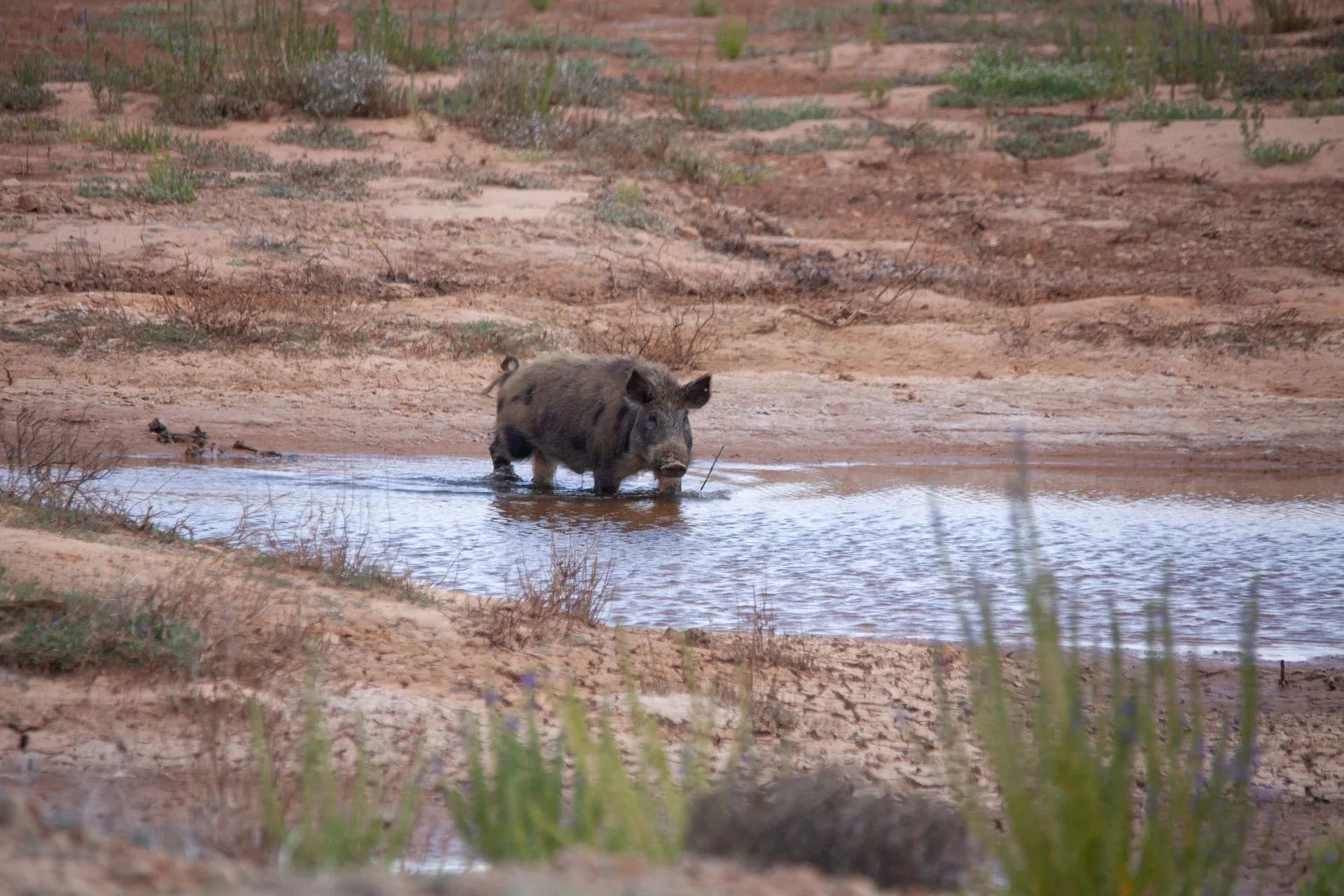
Image 1. Feral pigs cause significant damage to native vegetation and disrupt wildlife habitat.
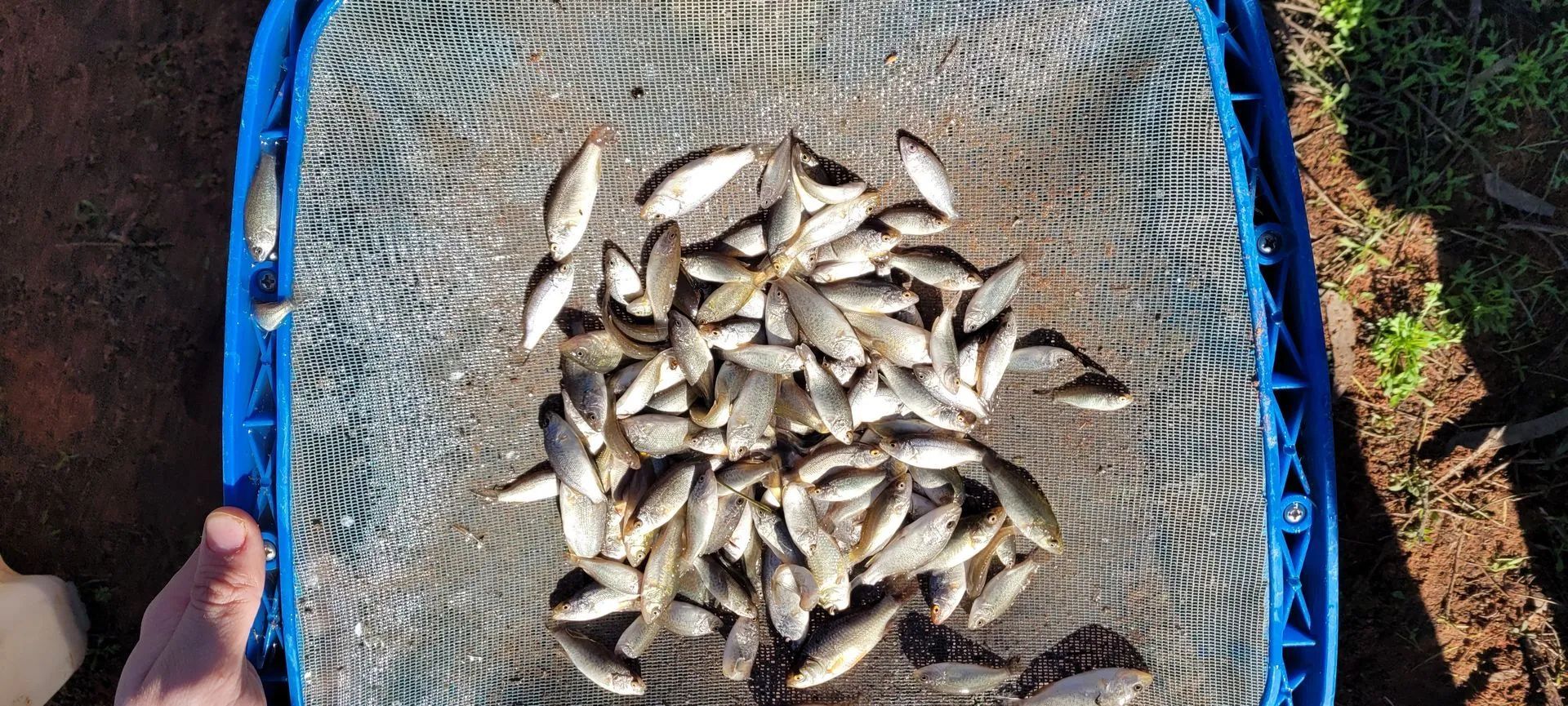
Image 2. Post flood aquatic survey work used to determine the numbers of fish in the wetland system.
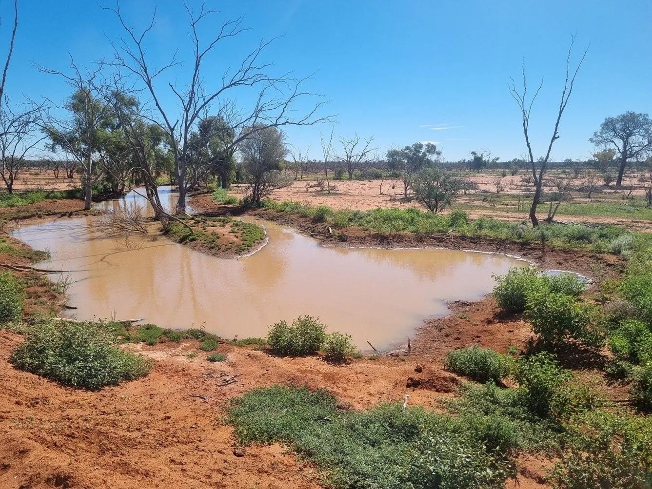
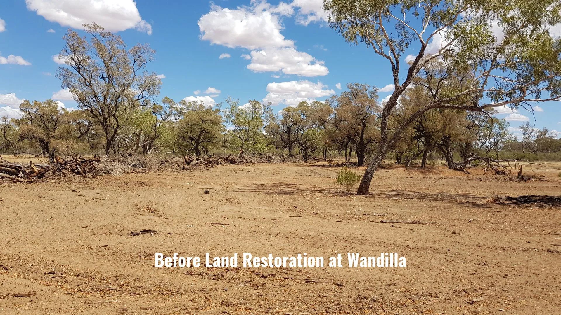
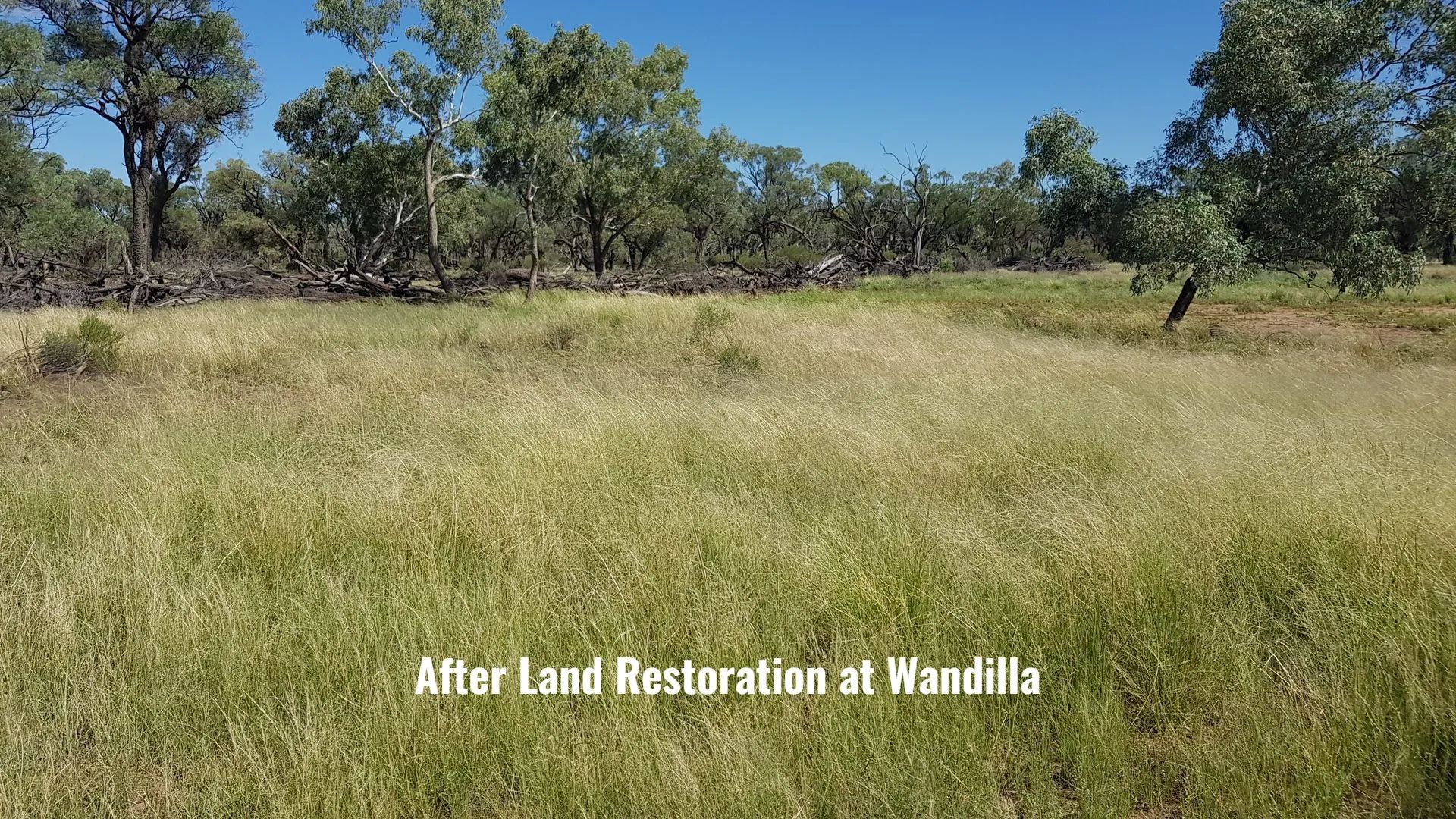
Image 3. Land rehydration work with water being held back, supporting new and existing
A number of key threats have been identified that pose ongoing pressure on the Currawinya Lakes Ramsar site. These include the spread of invasive weeds and the impacts of feral animals such as pigs, goats, and foxes, which can cause significant damage to native vegetation and disrupt wildlife habitat. Alterations to natural hydrological patterns, often resulting from upstream water use or climate variability, can reduce water availability and affect the timing and duration of flooding, critical processes that support the wetlands' ecological character. Other threats include declining land condition and deteriorating water quality, often linked to erosion, sedimentation, and nutrient runoff. Inappropriate or unregulated grazing regimes can further degrade soil and vegetation, while poorly designed or placed infrastructure such as roads and tracks may fragment habitats, interfere with water flow, and increase human disturbance in sensitive areas. Together, these factors threaten the long-term health and resilience of the Currawinya Lakes Ramsar site.
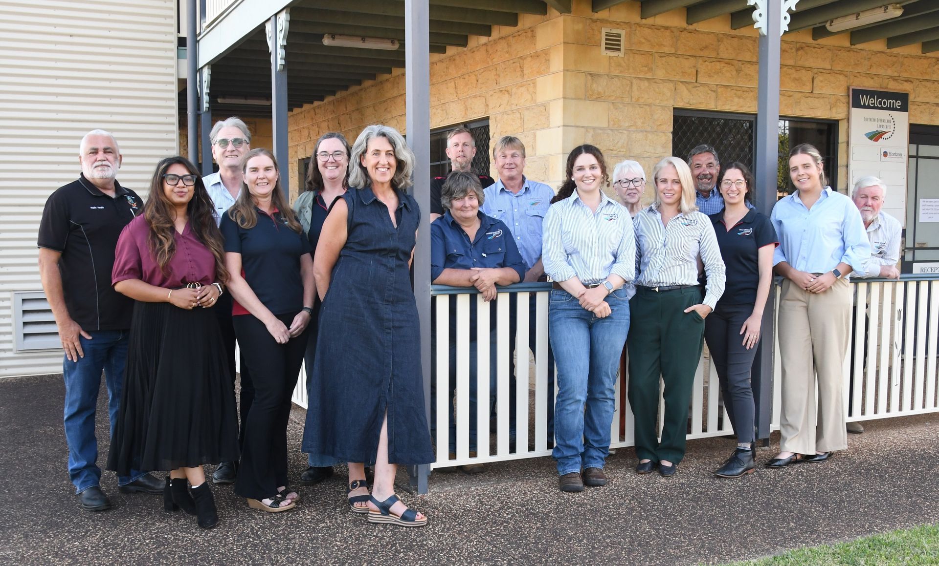
Southern Queensland Landscapes through the Restoring and Connecting Landscapes to Protect the Currawinya Ramsar Site project, have been working with landholders, local government, Traditional Owners and agencies using collaborative efforts in land management, monitoring and restoration to mitigate these threats and protect the rich biodiversity and environmental values the wetlands support. This will be achieved through improved groundcover management practices, hydrological regimes, pest management, and better stock management and infrastructure across prioritised areas.
The project will support the adoption of improved land management activities including:
- Restoring hydrology of floodplains and wetlands
- Install fencing to improve grazing management, livestock watering and protect habitat
- Controlling pest animals in priority areas
- Reduce invasive weeds in priority areas
In 2015, the Budjiti People's native title rights and interests were formally recognised by the Federal Court at Currawinya National Park marking a significant and proud milestone. This historic achievement was the result of respectful negotiations between the Queensland Government and the Budjiti People, culminating in a Protected Area Indigenous Land Use Agreement. The agreement supports the collaborative management of native title rights and interests within the park, fostering a strong partnership and shared commitment to caring for Country.
Read more about the Currawinya Wetlands.
Read more about the Currawinya Lakes Ramsar Wetlands Site.
Video's Related To This Project
Video Title
Video description text goes here.
This project is funded by the Australian Government’s Natural Heritage Trust and delivered by Southern Queensland Landscapes, a member of the Commonwealth Regional Delivery Partners Panel.